
 |
 |
|
#11
|
|||
|
|||
|
Grahame,
I have been wondering how you get those markers you have on your plane plotter map, such as DRUMO, NATLI etc? Leigh Wagga NSW |
|
#12
|
|||
|
|||
|
Those are waypoints. They are in a gpx file in the planeplotter chart files folder.
|
|
#13
|
|||
|
|||
|
Thanks Mike.
I've clicked on Options, Waypoint File, and clicked on every txt file listed, but nothing shows up on the east coast of Australia. Am I doing something wrong or do I have to get the information from somewhere else to to load to the chart files folder? Actually, looking at Plane Plotter help file, the Waypoint File option, is only used for ACARS operation. Leigh Last edited by Leigh R; 1st March 2018 at 05:41 PM. |
|
#14
|
|||
|
|||
|
I've clicked on Options, Chart, GPX Overlay, and have worked out how to show the overlays from there. There one which Grahame has doesnt seem to be there, but I am just creating my own. Thanks for the assistance.
|
|
#15
|
|||
|
|||
|
Looks like the default waypoints.gpx file in planeplotter only has UK Waypoints.
Where are you located? |
|
#16
|
|||
|
|||
|
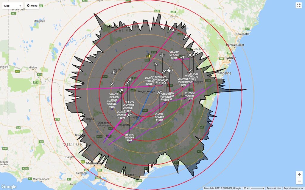
No idea when I got my spikes in distances, sadly would need to manually look at each day for the start/end point. Red rings are 100km and the orange 50km.
 Historically (2016 at some time, one of many I could find), I have had better range during DX events with range going all the way to Port Phillip Bay, Campbelltown, Dubbo, Cobar, Robinvale (near Mildura) and around 250km off the South Coast, but was history was lost when I had to reinstall the software. My antenna setup is well over due for maintenance.
__________________
Robert Myers Photography - Aviation Spotting Australia Flightradar24 feeder (F-YSWG1 & T-YSWG2) FlightAware feeder (YSWG/6482) |
|
#17
|
|||
|
|||
|
Hi Robert,
Im out near The Rock. Is your map from Virtual Radar software? thats a good coverage plot, there was some very good conditions on Tuesday, though I didn't see much increase in range here, but I know some others did. |
|
#18
|
||||
|
||||
|
You have a nice even 360 Degrees Range Plot there Robert (Antenna working very well) - Here is my latest Range Plot which runs to around 250nm over land, but over 600nm out to sea (more than half way to New Zealand at its best).
__________________
Joined 1999 @www16Right FlightDiary Airliners Web QR Retired PPL C150/172 PA28-161/181 Pitts S-2B SIM: 12Hr QF B767 B744 CX B742 Nikon D100-D200-D300-D500 |
|
#19
|
|||
|
|||
|
Looks amazing Grahame. Looks like around 700 nm to me. 1200 km or so.
|
|
#20
|
||||
|
||||
|
Correct Leigh, the best pickup has been 759.4nm for NZ191 Auckland-Adelaide at Bearing 116.5 Degrees and 38,000ft.
__________________
Joined 1999 @www16Right FlightDiary Airliners Web QR Retired PPL C150/172 PA28-161/181 Pitts S-2B SIM: 12Hr QF B767 B744 CX B742 Nikon D100-D200-D300-D500 |
 |
|
|